Afar
The Afar Region, formerly known as Region 2, is a regional state in northeastern Ethiopia and the homeland of the Afar people. Its capital is the planned city of Semera, which lies on the paved Awash–Assab highway. It’s bordered by Eritrea to the north and Djibouti to the northeast; it also shares regional borders with the Tigray, Amhara, Oromo and Somali regions.
The Afar Triangle, the northern part of which is the Danakil Depression, is part of the Great Rift Valley of Ethiopia, and is located in the north of the region. It has the lowest point in Ethiopia and one of the lowest in Africa. The southern part of the region consists of the valley of the Awash River, which empties into a string of lakes along the Djibouti–Ethiopia border. Other notable landmarks include the Awash National Park.

Based on the 2017 projections by the Central Statistical Agency of Ethiopia (CSA), the Afar Regional State has a population of 1,812,002, consisting of 991,000 men and 821,002 women; urban inhabitants number 346,000 of the population, a further 1,466,000 were pastoralists.
Environment
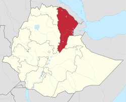
The Afar Depression, a plate tectonic triple junction, is found in the Afar Regional State. This geologic feature is one of Earth’s great active volcanic areas. Due to this volcanic activity the floor of the depression is composed of lava, mostly basalt.

The continuous process of volcanism results in the occurrence of major minerals, including potash, sulfur, salt, bentonite and gypsum. In addition to these minerals, there are also promising geothermal energy sources and hot springs in different areas of the region. Most of the region’s mineral potential are found in Dallol, Berhale and Afdera woredas of Zone Two. Elidar, Dubti and Millee in Zone One, and Gewane in Zone Three, also have some mineral possibilities.